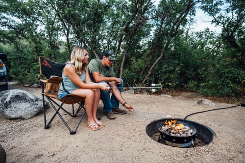
Ant Knolls
Distance: 3.4 mile out-and-back trail
Level: easy
Duration: an average of 1 hour 59 minutes to complete
Best times to visit: May - October
Notes: This trail is great for hiking. Dogs are welcome, but must be on a leash.
Big Pole Saddle View Trail
Distance: 5.0 mile out-and-back trail
Level: easy
Duration: an average of 2 hours 14 minutes to complete
Best times to visit: May - October
Notes: This is a popular trail for hiking, mountain biking, and running. The trail is open year-round and is beautiful to visit anytime. Dogs are welcome, but must be on a leash.
Burnt Ridge Connect Trail
Distance: 1.5 mile out-and-back trail
Level: easy
Duration: an average of 40 minutes to complete
Best times to visit: April - October
Notes: This is a popular trail for birding, hiking, and horseback riding. Dogs are welcome, but must be on a leash.
Cascade Springs Trail
Distance: 0.8 mile heavily trafficked loop
Level: easy
Duration: an average of 19 minutes to complete
Best times to visit: May - October
Notes: This Interpretive Trail is located near Midway, Utah and features a series of small waterfalls, streams, and pools. This experience is good for all skill levels and abilities. The trail is primarily used for walking, nature trips, and bird watching. The water is protected, so neither people nor dogs are allowed in the pools or streams. Dogs are welcome, but must be on a leash.
Cottontail Loop
Distance: 1.4 mile loop trail
Level: easy
Duration: an average of 38 minutes to complete
Best times to visit: May - October
Notes: This is a popular trail for birding, hiking, mountain biking, and horseback riding. Dogs are welcome, but must be on a leash.
Cottonwood Loop Trail
Distance: 0.72 mile one-way
Level: easy
Duration: an average of 8 minutes to complete
Best times to visit: May - October
Notes: This is a popular trail for biking. Dogs are welcome, but must be on leash.
Cummings Parkway OHV Trail
Distance: 17.9 mile point-to-point trail
Level: easy
Duration: an average of 10 hours 8 minutes to complete
Best times to visit: May - October
Notes: This is a very popular trail for off-road driving, so use caution if you are mountain biking or hiking. Dogs are NOT allowed on this trail.
Deer Creek Perimeter Trail
Distance: 15 mile out-and-back trail
Level: easy
Best times to visit: May - October
Notes: This moderately trafficked trail is located along the Deer Creek State Park and Reservoir shoreline. It features lake and mountain views, and is good for all skill levels. The trail is primarily used for mountain biking and e-biking and is accessible year-round.
Deer Valley Trail System - Area Map
Double Dutch Trail
Distance: 0.44 mile out-and-back connector trail
Level: easy
Duration: an average of 10 minutes to complete
Best times to visit: May - October
Notes: This trail is a great connector between Luge and Dutchman Way to Cottontail Loop to avoid using the gravel Dutch Canyon access road. This is a popular trail for hiking and mountain biking. Dogs are welcome, but must be on a leash.
Duma Trail
Distance: 0.03 mile one-way
Level: easy
Duration: an average of 1 minute to complete
Best times to visit: May - October
Notes: This is a popular, short singletrack trail located near Midway Utah. This two-directional trail is ideal for biking. Dogs are welcome, but must be on a leash.
Dutch Hollow Trail System - Area Trail Map
Fairy Forest Trail
Distance: 0.7 mile out-and-back trail
Level: easy
Duration: an average of 14 minutes to complete
Best times to visit: May - October
Notes: Located along Mirror Lake Scenic Byway, this trail is great for camping and walking, and it's unlikely you'll encounter many other people while exploring. This trail is ideal for younger children. Dogs are welcome, but must be on a leash.
Flatline Trail
Distance: 2.0 mile out-and-back trail
Level: easy
Duration: an average of 16 minutes to complete
Best times to visit: May - October
Notes: This is a popular trail for hiking, running, and mountain biking. This trail is a great connector between the Riverview Trails and the Coyote Loop. Dogs are welcome, but must be on a leash.
Gopher Flats
Distance: 0.33 mile one-way
Level: easy
Duration: an average of 3 minutes to complete
Best times to visit: May - October
Notes: This trail winds through an open meadow and is popular for biking. Use this trail to avoid riding uphill on Barrel Trail when other riders are coming downhill. This is a good trail to use to loop the Barrel Trail
Heber Valley Overlook
Distance: 2.3 mile loop trail
Level: easy
Duration: average of 56 minutes to complete
Best times to visit: April - October
Notes: This is a popular trail (located in the Dutch Hollow Trail System) for birding, hiking, and horseback riding. Dogs are welcome, but must be on a leash.
Huber Grove Trail
Distance: 1.8 mile out-and-back trail
Level: easy
Duration: an average of 42 minutes to complete
Best times to visit: April - September
Notes: This moderately trafficked trail is located near Midway, Utah, features beautiful wildflowers, and is good for all skill levels. The trail offers a number of activity options and fun area history. Dogs are welcome, but must be on a leash.
Lime Canyon Trail
Distance: 1.74 mile out-and-back trail
Level: easy
Duration: an average of 28 minutes to complete
Best times to visit: May - October
Notes: This is a popular doubletrack trail for mountain biking, and it's unlikely you'll encounter many other people while exploring. Dogs are welcome, but must be on a leash.
Lower Riverview Trail
Distance: 1.2 mile one-way
Level: easy
Duration: an average of 8 minutes to complete
Best times to visit: May - October
Notes: This trail features smooth and flowing singletrack with no significant altitude gain. Great for biking and hiking. Dogs are welcome, but must be on a leash in parking areas.
Luge (Up) Trail
Distance: 0.12 mile one-way trail
Level: easy
Duration: an average of 1 minute to complete
Best times to visit: May - October
Notes: This is a nice trail for biking to get to Interlaken from the south, or when doing Luge Trail laps. Dogs are welcome, but must be on a leash.
Memorial Hill
Distance: 2.1 mile out-and-back trail
Level: easy
Duration: an average of 46 minutes to complete
Best times to visit: any time of the year
Notes: This trail is great for hiking, running, and walking, and is also open to vehicular traffic. It is multi-user and multi-directional, so use with caution and awareness of other users. This trail is open year-round and is great to visit any time of the year. Dogs are welcome, but must be on a leash.
Mill Hollow Trail
Distance: 4.7 mile out-and-back trail
Level: easy
Duration: an average of 1 hour 50 minutes to complete
Best times to visit: May - October
Notes: This is a popular trail for hiking and walking. The trail is open year-round and is beautiful to visit anytime. Dogs are welcome, but must be on a leash.
Nobletts Creek Trail
Distance: 2.1 mile out-and-back trail
Level: easy
Duration: an average of 53 minutes to complete
Best times to visit: May - October
Notes: This is a popular trail for hiking and horseback riding, but you can still enjoy some solitude during quieter times of day. Dogs are welcome, but must be on a leash.
Pine Creek Nature Trail
Distance: 0.50 mile one-way trail
Level: easy
Duration: 2-mile loop
Best times to visit: May - October
Notes: This nicely kept single track trail is fun for families. Offering an easy hike to a boulder field. Dogs are welcome, but must be on a leash.
Sage Trail
Distance: 2.8 mile out-and-back trail
Level: easy
Duration: an average of 1 hour 24 minutes to complete
Best times to visit: May - October
Notes: This is a popular trail for hiking, horseback riding, and mountain biking. Dogs are welcome, but must be on a leash.
Side Barr Trail
Distance: 1.0 mile out-and-back trail
Level: easy
Duration: an average of 28 minutes to complete
Best times to visit: May - October
Notes: This trail is great for camping and hiking. Dogs are welcome, but must be on a leash.
S’more Trail
Distance: 0.52 mile out-and-back trail
Level: easy
Duration: an average of 14 minutes to complete
Best times to visit: May - October. Notes: This trail is great for hiking and mountain biking. Dogs are welcome, but must be on a leash.
SoHo Ridge Loop
Distance: 3.9 mile loop trail
Level: easy
Duration: an average of 2 hours 16 minutes to complete
Best times to visit: May - October
Notes: This trail is great for hiking, horseback riding, running, and mountain biking.
Spin 'N Grin Trail
Distance: 0.24 one-way trail
Level: easy
Duration: an average of 5 minutes to complete
Best times to visit: May - October
Notes: This trail is part of the Soldier Hollow trail system, and a trail pass is required to use this trail system. The trail is single-track and multi-directional, and is ideal for mountain biking traffic. The trail connects to The Hollow trail.
SR-113 Trail
Distance: ~2 miles
Level: easy
Duration: 10 minutes
Best times to visit: April - October
Notes: The paved SR-113 Trail in Wasatch County connects Tate Lane to Main Street in Midway. It provides a recreational paved path near the intersection of SR-113 and Tate Lane, extending north towards downtown Midway. Common for walkers and runners. Watch for other people and dogs.
Strawberry Nature Boardwalk & Discovery River Trail
Distance: 4.3 mile loop trail
Level: easy
Duration: an average of 1 hour 22 minutes to complete
Best times to visit: May - October
Notes: Follow the boardwalk trail at the Strawberry Reservoir Visitor Center downstream along the Strawberry River to view the incredible diversity of wildlife in this riparian corridor. Signs along the trail tell about the wildlife that are attracted to this habitat. Follow the trail upstream to see trout and salmon spawning during the spring and fall seasons.
Valais Park Loop
Distance: 0.8 mile loop trail
Level: easy
Duration: an average of 15 minutes to complete
Best times to visit: May - October
Notes: This is a popular trail for walking and pedestrian traffic. Dogs are welcome, but must be on a leash.
Wall Lake Trail
Distance: 2.5 mile out-and-back trail
Level: easy
Duration: an average of 52 minutes to complete
Best times to visit: May - October
Notes: This is a very popular area for camping, fishing, and hiking, so you'll likely encounter other people while exploring. Dogs are welcome, but must be on a leash.
Wasatch Mountain State Park Visitor Center - Area Trail Map
Water Works Trail
Distance: 0.6 mile out-and-back trail
Level: easy
Duration: an average of 14 minutes to complete
Best times to visit: May - October
Notes: This gravel path bypasses the main road and is a great trail to return on after riding at the pump track. This trail is great for hiking, running, and mountain biking. Dogs are welcome, but must be on a leash.
1000 Turns
Distance: 3.6 mile out-and-back trail
Level: intermediate
Duration: an average of 1 hour 45 minutes to complete
Best times to visit: April - September
Notes: This moderately trafficked trail is popular for birding, hiking, and mountain biking. Dogs are welcome, but must be on a leash.
Aqueduct Trail
Distance: 1.5 mile out-and-back trail
Level: intermediate
Duration: an average of 38 minutes to complete
Best times to visit: April - September
Notes: This is a popular trail for birding, hiking, and mountain biking. Dogs are welcome, but must be on a leash.
Alpine Summit
Distance: 4.1 mile out-and-back trail
Level: intermediate
Duration: an average of 1 hour 56 minutes to complete
Best times to visit: March - October
Notes: This is a popular trail for hiking, horseback riding, and mountain biking. This trail goes up to the Elk Campsite. Dogs are welcome, but must be on a leash.
BeepBeep
Distance: 1.85 miles one-way
Level: intermediate
Duration:
Best times to visit: April - October
Notes: Part of the Looney Tunes trail system, this trail connects to the short Putty Tat trail. BeepBeep has a few rock gardens that make the trail a bit more challenging but they are short and can be walked easily.
Big Pole Timpview Summit
Distance: 5.7 mile loop trail
Level: intermediate
Duration: an average of 2 hours 22 minutes to complete
Best times to visit: May - October
Notes: This trail is great for hiking and mountain biking. Dogs are welcome, but must be on a leash.
Birdie Shot Trail
Distance: 3.0 mile out-and-back trail
Level: intermediate
Duration: an average of 1 hour 20 minutes to complete
Best times to visit: May - October
Notes: This trail is great for hiking, mountain biking, and running. Dogs are welcome, but must be on a leash.
Bloods Lake Trail
Distance: 5.1 mile out-and-back trail
Level: intermediate
Duration: an average of 2 hours 38 minutes to complete
Best times to visit: May - October
Notes: This popular and heavily trafficked trail is located on the Guardsman Pass scenic drive and features beautiful wildflowers. The trail is primarily used for hiking. Parking can be full on weekends and holidays throughout the summer. Mid-week use is recommended. Dogs are NOT allowed at Bloods Lake, but are allowed at Lackawaxen Lake which is near and on the same trail system as Bloods Lake. Please follow all marked signage regarding access for dogs.
BLT (Bonanza Loop Trail) to WOW Connector
Distance: 5 mile one-way
Level: intermediate
Best times to visit: May - October
Notes: This roughly 5-mile backcountry trail network offers varying difficulty levels across its sections. It is generally described as a intermediate, multi-use, bi-directional trail that connects the Summit and Wasatch County trail systems.
Bonanza Peak
Distance: 6.9 mile out-and-back trail
Level: intermediate
Duration: an average of 3 hours 22 minutes to complete
Best times to visit: May - October
Notes: This trail is great for hiking. Dogs are welcome, but must be on a leash.
Burgi Hill Trail
Distance: 2.2 mile out-and-back trail
Level: intermediate
Duration: an average of 1 hour 5 minutes to complete
Best times to visit: May - October
Notes: This connector trail intersects with Interlaken and curves around Burgi Hill (elevation 6,071 feet). The local Burgi Hill park is near this trailhead. Dogs are welcome, but must be on a leash.
Cataract Gorge Trail
Distance: 6.4 mile out-and-back trail
Level: intermediate
Duration: an average of 3 hours to complete
Best times to visit: May - October
Notes: Located along Mirror Lake Scenic Byway, this trail is great for hiking, mountain biking, and off-road driving, and it's unlikely you'll encounter many other people while exploring. Dogs are welcome, but must be on leash.
Center Canyon Trail
Distance: 3.6 mile out-and-back-trail
Level: intermediate
Duration: an average of 1 hour 47 minutes to complete
Best times to visit: May - September
Notes: Enjoy this trail near Wallsburg, Utah. This trail is great for cross-country skiing, hiking, and off-road driving, and it's unlikely you'll encounter many other people while exploring.
Chair Hill Trail
Distance: 2.1 mile out-and-back trail
Level: intermediate
Duration: an average of 1 hour 26 minutes to complete
Best times to visit: May - October
Notes: This trail is great for hiking, and is open year-round. Dogs are welcome and may be off leash in some areas.
Chop’d Coyote Trail
Distance: 3.8 mile out-and-back trail
Level: intermediate
Duration: an average of 1 hour to complete
Best times to visit: May - October
Notes: This trail features lots of switchbacks and hairpin turns. Total elevation change of 1,005 feet. This is a popular trail for mountain biking. Dogs are welcome, but must be on a leash.
Co-op Creek Trail
Distance: 8.1 mile
Level: intermediate
Best times to visit: May - October
Notes: This mostly smooth gravel road trail provides access to multiple other trails. This trail is popular for hiking, biking, and off-roading.
Crow’s Nest
Distance: 5.1 mile loop trail
Level: intermediate
Duration: an average of 2 hours 41 minutes to complete
Best times to visit: March - October
Notes: This is a popular trail accessible via Huber Grove. This trail is ideal for birding and hiking. Dogs are welcome, but must be on a leash.
Deer Valley Trail System - Area Map
Donkey Ridge Trail - Upper Trail / Lower Trail
Distance: 2.2 mile out-and-back trail
Level: intermediate
Duration: average of 1 hour 6 minutes to complete
Best times to visit: April - October
Notes: This is a popular trail for birding, hiking, and horseback riding. Dogs are welcome, but must be on a leash.
Dry Canyon Trail
Distance: 3.0 mile out-and-back trail
Level: intermediate
Duration: an average of 1 hour 58 minutes to complete
Best times to visit: June - October
Notes: This trail is great for hiking. Dogs are welcome, but must be on a leash.
Duchesne Ridge to Heart Lake
Distance: 12.5 mile out-and-back trail
Level: intermediate
Duration: an average of 5 hours 29 minutes to complete
Best times to visit: May - October
Notes: This trail is great for hiking and mountain biking. Dogs are welcome, but must be on a leash.
Dutchman Way Trail
Distance: 0.2 mile connector trail
Level: intermediate
Duration: average of 10 minutes to complete
Best times to visit: May - October
Notes: This straightforward trail is a north/south route that connects trails like Donkey Ridge Trail and Prospect Trail.
Enchanted Forest Trail
Distance: 2.5 mile out-and-back trail
Level: intermediate
Duration: an average of 1 hour 19 minutes to complete
Best times to visit: April - October
Notes: This is a popular trail for birding, hiking, and mountain biking. Dogs are welcome, but must be on a leash.
Foreman Hollow Trail
Distance: 3.9 mile loop
Level: intermediate
Duration: an average of 2 hours to complete
Best times to visit: May - September
Notes: This trail is great for cross-country skiing and hiking, and it's unlikely you'll encounter many other people while exploring. Dogs are welcome, but must be on a leash.
Gobblers Gulch Trail
Distance: 2.6 mile out-and-back trail
Level: intermediate
Duration: an average of 1 hour 24 minutes to complete.
Best times to visit: April - October
Notes: This is a popular trail for birding, hiking, and horseback riding. Dogs are welcome, but must be on a leash.
Interlaken Trail
Distance: 2.1 mile out-and-back trail
Level: intermediate
Duration: an average of 49 minutes to complete
Best times to visit: May - October
Notes: This is a popular trail for birding, hiking, and horseback riding. Dogs are welcome, but must be on a leash.
Jordanelle Reservoir Perimeter Trail
Distance: 29.2 mile out-and-back trail
Level: intermediate
Duration: an average of 11 hours 33 minutes to complete
Best times to visit: April - October
Notes: This popular trail is located on the Jordanelle State Park and Reservoir shoreline features lake and and mountain views. The trail is primarily used for hiking, walking, running, mountain biking, e-biking, and horses. Dogs are welcome, but must be on a leash.
Lackawaxen Lake Trail
Distance: 5.1 mile out-and-back trail
Level: intermediate
Duration: an average of 2 hours 38 minutes to complete
Best times to visit: May - October
Notes: This popular and heavily trafficked trail is located on the Guardsman Pass scenic drive and features beautiful wildflowers. The trail is primarily used for hiking. Parking can be full on weekends and holidays throughout the summer. Mid-week use is recommended. Dogs are welcome on this trail only, but must be on a leash. Dogs are NOT allowed at Bloods Lake, which is on the way to and near Lackawaxen Lake.
Little Joe Loop
Distance: 3.4 mile loop trail
Level: intermediate
Duration: an average of 1 hour 29 minutes to complete
Best times to visit: May - October
Notes: This is a popular trail for hiking. Dogs are welcome, but must be on a leash.
Phosphate Trail Loop
Distance: 6.1 mile loop trail
Level: intermediate
Duration: an average of 2 hours 41 minutes to complete
Best times to visit: April - October
Notes: This is a popular trail for birding, hiking, and mountain biking. Dogs are welcome, but must be on a leash.
Pine Canyon Pump Track & Bike Park
Distance:
Level: intermediate
Duration: not applicable
Best times to visit: April - October
Notes: Large gravel parking lot specifically for the bike park. Popular spot for youth mountain biking.
Pine Canyon Trail
Distance: 1.7 mile out-and-back trail
Level: intermediate
Duration: an average of 42 minutes to complete
Best times to visit: May - October
Notes: This is a popular trail for birding, hiking, and mountain biking. Dogs are welcome, but must be on a leash.
Pioneer Peak Trail
Distance: 6.0 mile out-and-back trail
Level: intermediate
Duration: an average of 4 hours 28 minutes to complete
Best times to visit: May - October
Notes: This trail is great for hiking. Dogs are welcome, but must be on a leash.
Prospect Trail
Distance: 2.5 mile loop trail
Level: intermediate
Duration: an average of 1 hour 14 minutes to complete
Best times to visit: May - October
Notes: This is a popular trail for birding, camping, and hiking. Dogs are welcome, but must be on a leash.
Red Ledges
Distance: 5.4 mile out-and-back trail
Level: intermediate
Duration: an average of 2 hours 25 minutes to complete
Best times to visit: April - October
Notes: This trail is great for hiking and running. Dogs are welcome, but must be on a leash.
Ridge Trail to 41
Distance: 12.9 mile loop trail
Level: intermediate
Duration: an average of 6 hours 31 minutes to complete
Best times to visit: March - November
Notes: This is a popular trail for hiking, mountain biking, and walking. Dogs are welcome, but must be on a leash.
Ridge Trail 157
Distance: 16.6 mile out-and-back trail
Level: intermediate
Duration: an average of 8 hours 56 minutes to complete
Best times to visit: June - October
Notes: This is a popular trail for hiking, horseback riding, and mountain biking. Dogs are welcome, but must be on a leash.
Riverview Connector Trail
Distance: 1.1 mile one-way
Level: intermediate
Duration: an average of 6 minutes to complete
Best times to visit: May - October
Notes: Located behind the UVU-Wasatch campus, this is a great trail connection between Upper Riverview Trail and Lower Riverview Trail. The climb is short and built on a nice grade. Switchbacks are tight but manageable for biking.
Riverview Trail Loop
Distance: 6.3 mile loop
Level: intermediate
Duration: an average of 2 hours 34 minutes to complete
Best times to visit: May - October
Notes: Enjoy this 6.3-mile loop trail near Heber City, Utah. Generally considered a moderately challenging route, it takes an average of 2 h 34 min to complete. This is a popular trail for hiking, mountain biking, and running, but you can still enjoy some solitude during quieter times of day.
Scout Falls Trail
Distance: 2.9 mile out and back trail
Level: intermediate
Duration: an average of 1 hour 42 minutes to complete
Best times to visit: May - October
Notes: Via Mount Timpanogos Trail, this heavily trafficked trail is located near Alpine, Utah, and features a waterfall at the end of the trail. Dogs are welcome, but must be on a leash.
SH Cascade Trail
Distance: 0.79 mile one-way trail
Level: intermediate
Duration: an average of 12 minutes to complete
Best times to visit: May - October
Notes: This trail is part of the Soldier Hollow trail system, and a trail pass is required to use this trail system. The trail is single-track and ideal for mountain biking traffic.
SH Dirt Track Trail
Distance: 2.0 mile one-way trail
Level: intermediate
Duration: an average of 13 minutes to complete
Best times to visit: May - October
Notes: This trail is part of the Soldier Hollow trail system, and a trail pass is required to use this trail system. The trail is double-track and ideal for mountain biking traffic.
Sheep Bones Trail
Distance: 1.0 mile one-way trail
Level: intermediate
Duration: an average of 12 minutes to complete
Best times to visit: May - October
Notes: This trail is best for biking. The trailhead is marked with a little sheep bones sign surrounded by sheep skulls.
Sheep Pen Trail
Distance: 0.96 mile one-way trail
Level: intermediate
Duration: an average of 7 minutes to complete
Best times to visit: May - October
Notes: This trail is best for biking. A slight climb and descent.
Smooth Groove Trail
Distance: 0.3 mile connector trail
Level: intermediate
Duration: an average of 10 minutes to complete
Best times to visit: May - October
Notes: Tight curves with an easy climb. This trail is great for hiking, running, and mountain biking. This is a connector trail. Dogs are welcome, but must be on a leash.
Snake Creek Trail
Distance: 15.2 mile out-and-back trail
Level: intermediate
Duration: an average of 6 hours 58 minutes to complete
Best times to visit: May - October
Notes: This trail is great for backpacking and hiking. Dogs are welcome, but must be on a leash.
Soapstone Basin OHV Trail
Distance: 49.5 mile loop trail
Level: intermediate
Duration: an average of 24 hours 11 minutes to complete
Best times to visit: May - October
Notes: Located along Mirror Lake Scenic Byway, this is a popular trail for off-road driving, but you can still enjoy some solitude during quieter times of the day.
Soldier Hollow South Trail
Distance: 1.6 mile one-way trail
Level: intermediate
Duration: an average of 8 minutes to complete
Best times to visit: May - October
Notes: This trail is part of the Soldier Hollow trail system, and a trail pass is required to use this trail system. The is a popular single-track trail that is multi-directional, and ideal for mountain biking traffic.
Stewart Falls Trail
Distance: 3.4 mile out and back trail
Level: intermediate
Duration: an average of 2 hours 30 minutes to complete
Best times to visit: May - October
Notes: This heavily trafficked trail is located along the Alpine Loop Scenic Backway with two points of entry. Start/end at either the stunning Sundance Mountain Resort property or farther up the road at the National Forest Service designated parking lot and trailhead. The end point of the trail features Stewart Falls, a multi-tiered waterfall. Dogs are welcome, but must be on a leash.
Strawberry Narrows
Distance: 10.6 mile one-way trail
Level: intermediate
Duration: an average of 4 hours to complete
Best times to visit: May - September
Notes: This point-to-point trail is located near Fruitland, Utah. The trail is great for camping, fishing, and hiking, and it's unlikely you'll encounter many other people while exploring. The trail is open year-round. Dogs are welcome, but must be on a leash.
The Hollow
Distance: 10.5 mile one-way trail
Level: intermediate
Duration: an average of 4 hours 9 minutes to bike
Best times to visit: May - October
Notes: This trail is part of the Soldier Hollow biking trail system, and a trail pass is required to use this trail system. The is a popular single-track trail that is multi-directional, and ideal for mountain biking traffic.
Top Notch Trail
Distance: 0.88 mile one-way trail
Level: intermediate
Duration: an average of 8 minutes to complete
Best times to visit: May - October
Notes: This trail is ideal for biking and has smooth berms and a fun, fast section on the east side. Great way to connect over to and from Phosphate Trail.
Upper Riverview Trail
Distance: 4.4 mile one-way trail
Level: intermediate
Duration: an average of 31 minutes to complete
Best times to visit: May - October
Notes: This singletrack trail is best for biking and connects with the Coyote Trail System.
Upper Soldier Hollow Loop
Distance: 2.8 mile one-way trail.
Level: intermediate
Duration: an average of 22 minutes to complete
Best times to visit: May - October
Notes: This trail is part of the Soldier Hollow trail system, and a trail pass is required to use this trail system. The is a popular single-track trail that is multi-directional, and ideal for mountain biking traffic.
Wasatch Mountain State Park Nature Trail
Distance: 2.5 mile loop trail
Level: intermediate
Duration: an average of 1 hour 14 minutes to complete
Best times to visit: May - October
Notes: This is a popular trail for birding, camping, and hiking. Dogs are welcome, but must be on a leash.
Wile E. Canyon Loop
Distance: 3.8 mile loop trail
Level: intermediate
Duration: an average of 1 hour 32 minutes to complete
Best times to visit: May - October
Notes: This trail is great for hiking, mountain biking, and running. Dogs are welcome, but must be on a leash.
Willow Hollow Trail
Distance: 2.2 mile out-and-back trail
Level: intermediate
Duration: an average of 1 hour 8 minutes to complete
Best times to visit: May - September
Notes: This is a popular trail for hiking, mountain biking, and running. Dogs are welcome and may be off-leash in some areas.
WOW Trail (Wasatch-Over-Wasatch)
Distance: 9.0 mile one-way trail
Level: intermediate (downhill)
Duration: an average of 1 hours 18 minutes to complete
Best times to visit: May - October
Notes: Accessible from the upper location of Wasatch Mountain State Park on Pine Canyon Road, this popular and often heavily trafficked trail has a total of 2,202 feet in elevation change. This two-direction trail is great for mountain biking. It is also popular for hiking and trail running along portions of the trail. Dogs are welcome, but must be on a leash.
Alpina Trail
Distance: 0.16 mile one-way trail
Level: hard
Duration: an average of 5 minutes to complete
Best times to visit: May - October
Notes: This trail is part of the Soldier Hollow trail system, and a trail pass is required to use this trail system. The trail is steep and tight with hairpin turns; ideal for downhill mountain biking traffic.
Boneyard Trail
Distance: 1.8 mile out and back trail
Level: hard
Duration: an average of 55 minutes to complete
Best times to visit: April - September
Notes: This moderately trafficked trail features beautiful wildflowers and is primarily used for hiking, nature trips, birding, and mountain biking. Dogs are welcome, but must be on a leash.
Coyote Canyon Loop
Distance: 22.7 mile loop
Level: hard
Duration: an average of 9 hours 21 minutes to complete
Best times to visit: May - September
Notes: This is a popular trail for hiking and mountain biking. Dogs are welcome, but must be on a leash in parking areas.
Deer Valley Trail System - Area Map
East Fork Three Forks Trail
Distance: 4.2 mile out-and-back trail
Level: hard
Duration: an average of 3 hours 24 minutes to complete
Best times to visit: May - October
Notes: This trail is great for hiking, horseback riding, and snowshoeing, and it's unlikely you'll encounter many other people while exploring. This trail is open year-round. Dogs are welcome, but must be on a leash.
Peak 8193
Distance: 8.7 mile out-and-back trail
Level: hard
Duration: an average of 5 hours 4 minutes to complete
Best times to visit: May - October
Notes: Accessible via Big Hollow Road, this trail starts across the street from the local gun range. This trail is great for hiking, and off-roading, and it's unlikely you'll encounter many other people while exploring. Dogs are welcome, but must be on a leash.
South Fork Little Deer Creek Trail
Distance: 8.5 mile out-and-back trail
Level: hard
Duration: an average of 3 hours 22 minutes to complete
Best times to visit: June - September
Notes: This picturesque hiking trail is located in the remote wilderness of the High Uintas Wilderness Area (to the northeast of Heber Valley, Utah). The trailhead is located near the Smith and Morehouse Reservoir and the trail winds through dense forests, along a river, and across open meadows. The trail is very difficult with some steep sections. The trail is a perfect destination for hikers seeking a remote and peaceful backcountry experience in the beautiful Utah wilderness. Dogs are welcome, but must be on a leash in parking areas.
Spin Cycle
Distance: 4.7 mile loop trail
Level: hard
Best times to visit: May - October
Notes: Spin Cycle earned it’s name in part from the antiquated washing machines found along the trail, as well as in part from the twisty turns through gullies. The trail is hand-cut singletrack at it’s finest, so don’t be expecting buff two-lane thoroughfare. The trail winds through thick sage, Aspen, and pine, as well as offers fantastic views of Jordanelle Reservoir.
Springer Hollow Trail
Distance: 2 miles
Level: hard
Best times to visit: May - September
Notes: The Springer Hollow trail is part of Dutch Hollow in Wasatch Mountain State Park. It is a hand-built, advanced downhill-only mountain bike trail that rides the line between single black and double black diamond with over 1,100 feet of vertical descent. Designed for experienced riders, featuring high-consequence steep, rocky, and technical terrain.
Timpooneke Trail
Distance: 15 mile out-and-back trail
Level: hard
Duration: 8+ hours
Best times to visit: May - September
Notes: Mount Timpanogos via Timpooneke Trail is a very popular and heavily trafficked trail located along the Alpine Loop Scenic Backway. The trail is primarily used for hiking, camping, and backpacking. Wildlife viewing is also popular on this trail. Dogs are welcome, but must be on a leash.
WOW Trail (Wasatch-Over-Wasatch)
Distance: 9.0 mile one-way trail
Level: hard (uphill)
Duration: an average of 4 hours to complete
Best times to visit: May - October
Notes: Accessible from the Oak Hollow Campground at Wasatch Mountain State Park, this popular and often heavily trafficked trail has a total of 2,202 feet in elevation climb. This two-directional trail is great for mountain biking. It is also popular for hiking and trail running along portions of the trail. Dogs are welcome, but must be on a leash.